Dongla trek

Dongla trek - 4 days & 3 nights

DAY 01 - Lhuentse Wangsi Lhakhang (travel time: 4 and a half hours; distance: 20 km)

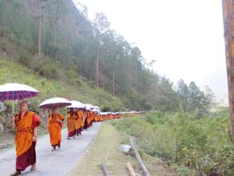
The trip begins at Tangma Chhu Bridge and travels through scenic paddy fields and villages. At a height of 1,830 meters, camping is available for the night.

DAY 02 - Wangsi Lhakhang Pemi (Duration: roughly 7.5 hours)

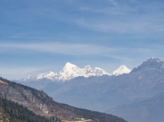
As you gradually ascent through thick forests, you'll catch glimpses of some magnificent mountains. Camp out for the night at a height of 2,430 meters.

DAY 03 - Pemi Toupang

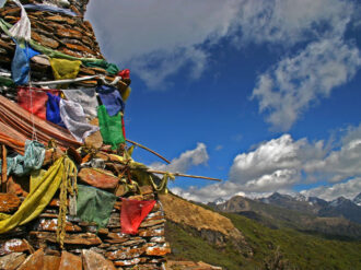
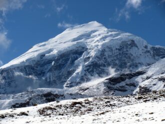
Continue uphill until you reach the 4,100-meter-high Dongla Pass. You will be treated to breath-taking views of the Himalayan mountains from this vantage point. From Dongla, descend through dense trees. Camping for the night at a height of 2,430 meters.

DAY 04 - Toupang Yangtse Chhoeten Kora

Set out on a descent via towns and thick forests. Yangtse Dzong is where the hike comes to an end. You will go 7 kilometers to Chhoeten Kora from there, where you will spend the night in the camp. A 52-kilometer trip takes you to Trashigang the following day.

Dongla trek
Gradually ascend through dense forests, offering glimpses of majestic mountains along the way. Set up camp for the night at an altitude of 2,430 m.
Chelela nature trek
hike involves a gradual ascent through picturesque farmland. The trail offers splendid views of Paro valley. Spend the night at Chonana campsite
Druk path trek
The trail ascends gradually through the forest of chirpine, spruce silver fir etc to the camp at Jele dzong at an altitude of 2,590m. Paro valley with snow-capped mountains in the background can be seen on a clear day.
Jhomolhari trek
The river then narrows and closes in and the trail winds along the drainage, ascending to the ruins of Barshong Dzong.
Punakha winter trek
short and simple journey across Punakha, the old capital of Bhutan. The trail's range is almost a thousand meters, but the slopes are mostly gentle and shouldn't be too difficult for hikers.
Gangtay trek
One of Bhutan's few glacial valleys, Gangtey (also known as Phobjikha) is where the endangered black necked cranes spend the winter, migrating annually from the Tibet
Tingtibi-Manas Trek
Gelephu under Sarpang district, at one time, was called Hati Zar due to high population of elephants. Gelephu is at 280 m above sea level and is the largest flat land in Bhutan. Take the 150 km drive from Gelephu to Gonphu and enjoy the ascent from 280 m-1450 m.
Merak and Sakten Trek
The kind of vegetation are deciduous as we start and temperate as we camp. Lots of magnolias and rhododendron species abound here.